917 CRESTWOOD LN
Owner Information
MULVEY, WILLIAM
917 CRESTWOOD LN
CLINTON, MA 01510


Property Details
917 CRESTWOOD LN is classified as a Residential Condominium (Condominium).
The primary structure on this property was built in 2019. There are 2,198ft2 of built area within this property. There is 1,578ft2 of residential/living space within this property. This property is listed as having 3 rooms.
917 CRESTWOOD LN is valued at $466,500. The land is valued at $0 and the structures are valued at $464,900. There is an additional valuation of $1,600 on this property.
The most recent deed for 917 CRESTWOOD LN is recorded at the local registrar in Book 62059, Page 66. 917 CRESTWOOD LN was last sold on Tuesday, March 17, 2020 for $433,400.
Assessment data from fiscal year 2022.
Flood Data
According to the FEMA National Flood Hazard Layer, this property does not appear to be in a flood zone. It may also be in an area not yet reviewed. Nonetheless, confirm this information prior to taking any action.
To view the flood hazards around this property, create a FEMA "Firmette" Map of the area around 917 CRESTWOOD LN.
Broadband Internet Providers
| Provider | Type | Bandwidth (mbps) | |
|---|---|---|---|
| HughesNet | Satellite | 25 | 3 |
| VSAT Systems, LLC. | Satellite | 2 | 1 |
| T-Mobile | Fixed Wireless | 25 | 3 |
| Verizon New England Inc. | DSL | 10 | 1 |
| Viasat Inc | Satellite | 100 | 3 |
| GCI Communication Corp. | Satellite | 0 | 0 |
| Comcast | Cable | 1000 | 35 |
Broadband service provider data from December 2020.
Adjacent Properties
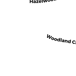
- 1207 HAZELWOOD WAY
Residential Condominium owned by RYLL SUFFIN, KAREN - 1211 HAZELWOOD WAY
Residential Condominium owned by RIZZO, SALVATORE P - 1213 HAZELWOOD WAY
Residential Condominium owned by CLOUGHER, MARIE - 1214 HAZELWOOD WAY
Residential Condominium owned by SPINAZOLA, CHRISTOPHER - 1215 HAZELWOOD WAY
Residential Condominium owned by STANLEY DAVID - 1216 HAZELWOOD WAY
Residential Condominium owned by LINDE, RICHARD - 1217 HAZELWOOD WAY
Residential Condominium owned by SOTTILE , GERTRUDE A - 1218 HAZELWOOD WAY
Residential Condominium owned by CARRIGAN, KAREN B - 1219 HAZELWOOD WAY
Residential Condominium owned by WYNER, ELAINE F - 1223 HAZELWOOD WAY
Residential Condominium owned by HIGGINS WILLIAM - 1401 KENWOOD WAY
Residential Condominium owned by ROCHE, KATELIN JADE - 1402 KENWOOD WAY
CONDO NL R owned by LAUX AGNES MARILYN - 1403 KENWOOD WAY
Residential Condominium owned by EL BIZRI, TAREK - 1404 KENWOOD WAY
CONDO NL R owned by LEBLANC SOLANGE - 1405 KENWOOD WAY
Residential Condominium owned by COUGHLIN, MATTHEW PAUL - 424 FERNWOOD LN
CONDO NL R owned by ZHANG, LEI - 426 FERNWOOD LN
CONDO NL R owned by JOSEPH H FRANK TRUST - 430 BOXWOOD LN
CONDO NL R owned by DIEGNAN JOHN L - 431 BOXWOOD LN
CONDO NL R owned by MALYSKA CARLA B - 432 BOXWOOD LN
CONDO NL R owned by BURGWINKLE BRUCE A - 433 BOXWOOD LN
CONDO NL R owned by ROCK NINA L - 502 LINWOOD CT
CONDO NL R owned by TEPERDJIAN QUALIFIED DOMESTIC TRUST - 201-212 BOXWOOD LN
Other, Open Space owned by None - 1406 KENWOOD WAY
CONDO NL R owned by MAKOVOZ, BORIS - 1407 KENWOOD WAY
Residential Condominium owned by FERREE, MARK B - 1408 KENWOOD WAY
CONDO NL R owned by SWEENEY CAROL J - 1409 KENWOOD WAY
Residential Condominium owned by WOODMAN, BETSY - 1411 KENWOOD WAY
Residential Condominium owned by OLNEY, KRISTI - 201 CHERRYWOOD LN
CONDO NL R owned by MATANO, RICHARD E - 201-212 BOXWOOD LN
Other, Open Space owned by None - 202 CHERRYWOOD LN
CONDO NL R owned by TREMARCHE MARIE R - 203 CHERRYWOOD LN
CONDO NL R owned by NAVAROLI DANIEL J - 204 CHERRYWOOD LN
CONDO NL R owned by SHIBLEY FAMILY IRREV TRUST - 503 LINWOOD CT
CONDO NL R owned by CELLINI NANCY J - 504 LINWOOD CT
CONDO NL R owned by VERUKI ELIZABETH - 505 LINWOOD CT
CONDO NL R owned by REEDY JOHN W JR - 506 LINWOOD CT
CONDO NL R owned by FURROW, KEVIN WARREN - 507 LINWOOD CT
CONDO NL R owned by SCHOFIELD, MARY C - 508 LINWOOD CT
CONDO NL R owned by ROBINSON, THOMAS R - 509 LINWOOD CT
CONDO NL R owned by 509 LINWOOD CT NOMINEE REALTY TRUST - 510 LINWOOD CT
CONDO NL R owned by MANAMPERI JAYAWEERA B - 512 LINWOOD CT
CONDO NL R owned by HEBERT EILEEN M - 513 LINWOOD CT
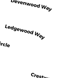
CONDO NL R owned by JONES ANGELA E - 601 DEVENWOOD WAY
CONDO NL R owned by CURTIS, HEIDI M - 602 DEVENWOOD WAY
CONDO NL R owned by CALLAHAN, JEROME C - 603 DEVENWOOD WAY
CONDO NL R owned by CERRONE PATRICIA - 604 DEVENWOOD WAY
CONDO NL R owned by ENTERKIN ROBERT - 605 DEVENWOOD WAY
CONDO NL R owned by BRADLEY, JOHN K - 606 DEVENWOOD WAY
CONDO NL R owned by HORGAN JULIA E - 607 DEVENWOOD WAY
CONDO NL R owned by BURGWINKLE, PATRICIA A - 608 DEVENWOOD WAY
CONDO NL R owned by JENNINGS FAMILY IRREV TRUST - 609 DEVENWOOD WAY
CONDO NL R owned by PHAYRE, JANE - 205 CHERRYWOOD LN
CONDO NL R owned by CHIAPPETTA CHRISTOPHER S - 206 CHERRYWOOD LN
CONDO NL R owned by ALEO LOUISE F - 208 CHERRYWOOD LN
CONDO NL R owned by HUTNER GARY - 210 CHERRYWOOD LN
CONDO NL R owned by THOMAS RICHARD D - 2101 BRIARWOOD VILLAGE
CONDO NL R owned by AMARAL LOREN T - 2102 BRIARWOOD VILLAGE
CONDO NL R owned by SCHEXNAYDRE PATRICIA ANN - 2103 BRIARWOOD VILLAGE
CONDO NL R owned by LEIGHTON PAULA J - 2104 BRIARWOOD VILLAGE
CONDO NL R owned by ZUIEWSKI, NANCY - 2105 BRIARWOOD VILLAGE
CONDO NL R owned by MCINNIS JACQUELYN - 2106 BRIARWOOD VILLAGE
CONDO NL R owned by ALIREZAIE, ELIN - 2107 BRIARWOOD VILLAGE
CONDO NL R owned by FLANAGAN SUSAN C - 2108 BRIARWOOD VILLAGE
CONDO NL R owned by ABRAHAM MARYELLEN L - 2109 BRIARWOOD VILLAGE
CONDO NL R owned by HICKEY, DARREN - 2110 BRIARWOOD VILLAGE
CONDO NL R owned by GOMES, COREY - 2112 BRIARWOOD VILLAGE
CONDO NL R owned by JOYCE M DUMAS TRUST - 212 CHERRYWOOD LN
CONDO NL R owned by THE SHIRLEY M CONRADT 2005 REV TRUST - 2201 BRIARWOOD VILLAGE
CONDO NL R owned by FAIRLEY NANCY E - 610 DEVENWOOD WAY
CONDO NL R owned by KOWALONEK JOHN A - 611 DEVENWOOD WAY
CONDO NL R owned by FRANK, CHRISTOPHER J - 612 DEVENWOOD WAY
CONDO NL R owned by FOLEY, ANNE W - 614 DEVENWOOD WAY
CONDO NL R owned by DOBRANSKI LOUISE N - 615 DEVENWOOD WAY
CONDO NL R owned by BURKE JOHN T - 616 DEVENWOOD WAY
CONDO NL R owned by DICHTER, ERIK J - 617 DEVENWOOD WAY
CONDO NL R owned by VETRAS PHYLLIS K - 618 DEVENWOOD WAY
CONDO NL R owned by TULADHAR PRANAYA - 619 DEVENWOOD WAY
CONDO NL R owned by MORAND YONOK H - 620 DEVENWOOD WAY
CONDO NL R owned by SPIELMAN LISA D - 621 DEVENWOOD WAY
CONDO NL R owned by COWELL DAVID - 622 DEVENWOOD WAY
CONDO NL R owned by KAMINS SANDRA M - 623 DEVENWOOD WAY
CONDO NL R owned by O'NEIL WILLIAM E JR - 624 DEVENWOOD WAY
CONDO NL R owned by 624 DEVENWOOD WAY RLTY TRUST - 626 DEVENWOOD WAY
CONDO NL R owned by FITZGERALD, MARY A - 627 DEVENWOOD WAY
CONDO NL R owned by SHALLICE CHRISTOPHER - 628 DEVENWOOD WAY
CONDO NL R owned by THOROGOOD, GEORGE E - 629 DEVENWOOD WAY
CONDO NL R owned by KANTROWITZ, HEATHER FAYTH - 2202 BRIARWOOD VILLAGE
CONDO NL R owned by MARTIN MARY E - 2203 BRIARWOOD VILLAGE
CONDO NL R owned by MILLER, PAMELA F - 2204 BRIARWOOD VILLAGE
CONDO NL R owned by THOMAS, MARILYN I - 2205 BRIARWOOD VILLAGE
CONDO NL R owned by PAGNONI JOSEPH M - 2206 BRIARWOOD VILLAGE
CONDO NL R owned by WINKELMAN MARY ELLEN - 2207 BRIARWOOD VILLAGE
CONDO NL R owned by WYCKSTROM MARK - 2208 BRIARWOOD VILLAGE
CONDO NL R owned by CURLEY THOMAS L - 2209 BRIARWOOD VILLAGE
CONDO NL R owned by WALLAT LISA D - 2211 BRIARWOOD VILLAGE
CONDO NL R owned by HOLT, FRANCIS XAVIER - 2212 BRIARWOOD VILLAGE
CONDO NL R owned by SACINO DAVID G - 2301 BRIARWOOD VILLAGE
CONDO NL R owned by MCLAUGHLIN 2301 BRIARWOOD REALTY TRUST - 2302 BRIARWOOD VILLAGE
CONDO NL R owned by BANNON PETER - 2303 BRIARWOOD VILLAGE
CONDO NL R owned by HART MICHAEL J - 2304 BRIARWOOD VILLAGE
CONDO NL R owned by BRAGA ZELIA F - 2305 BRIARWOOD VILLAGE
CONDO NL R owned by MATSIK DOROTHY - 2306 BRIARWOOD VILLAGE
CONDO NL R owned by DAY, KEITH F - 2307 BRIARWOOD VILLAGE
CONDO NL R owned by CUTLER DENISE - 630 DEVENWOOD WAY
CONDO NL R owned by FRIGON RADLEY FAMILY TRUST - 631 DEVENWOOD WAY
CONDO NL R owned by ENGLAND ROY - 632 DEVENWOOD WAY
CONDO NL R owned by AYERS CATHLEEN A - 634 DEVENWOOD WAY
CONDO NL R owned by CANAVAN CYNTHIA G - 635 DEVENWOOD WAY
CONDO NL R owned by GARCIA RICHARD L - 636 DEVENWOOD WAY
CONDO NL R owned by SMID, DERK - 637 DEVENWOOD WAY
CONDO NL R owned by BARBERIO ANTHONY J - 638 DEVENWOOD WAY
CONDO NL R owned by EUNICE C GORMAN IRREV TRUST - 639 DEVENWOOD WAY
CONDO NL R owned by ARNOLD CHRISTOPHER J - 640 DEVENWOOD WAY
CONDO NL R owned by STIMENS, WAYNE D - 641 DEVENWOOD WAY
CONDO NL R owned by PHILBIN, KATE M - 642 DEVENWOOD WAY
CONDO NL R owned by KOVACS SHERRY A - 643 DEVENWOOD WAY
CONDO NL R owned by SHAFFER LAURA A - 644 DEVENWOOD WAY
CONDO NL R owned by CURTIS ELLEN - 647 DEVENWOOD WAY
CONDO NL R owned by GRANT STEVEN M - 649 DEVENWOOD WAY
CONDO NL R owned by GIRGIS NAGI G - 651 DEVENWOOD WAY
CONDO NL R owned by SARDELLA FAMILY TRUST - 653 DEVENWOOD WAY
CONDO NL R owned by STRAND, JUSTIN - 2308 BRIARWOOD VILLAGE
CONDO NL R owned by LIPKA STEPHEN M - 2309 BRIARWOOD VILLAGE
CONDO NL R owned by SHEPARD WENDY A - 2310 BRIARWOOD VILLAGE
CONDO NL R owned by REKUN, SERGE - 2311 BRIARWOOD VILLAGE
CONDO NL R owned by GERALDINE BATEMAN LIVING TRUST - 2312 BRIARWOOD VILLAGE
CONDO NL R owned by BRADLEY, ELIZABETH - 301 SPRUCEWOOD LANE
Residential Condominium owned by CHUGH, JOY - 302 SPRUCEWOOD LANE
CONDO NL R owned by KANNAPPAN, MUHIL - 303 SPRUCEWOOD LANE
Residential Condominium owned by MONTALBANO, ANDREW - 305 SPRUCEWOOD LANE
Residential Condominium owned by TALL PINES REALTY CORP - 306 SPRUCEWOOD LANE
CONDO NL R owned by SOUTHWORTH WILLIAM - 307 SPRUCEWOOD LANE
CONDO NL V owned by NORTH COUNTRY DEVELOPERS LLC - 308 SPRUCEWOOD LANE
CONDO NL R owned by UNGERER ROLAND H - 309 SPRUCEWOOD LANE
CONDO NL V owned by NORTH COUNTRY DEVELOPERS LLC - 310 SPRUCEWOOD LANE
CONDO NL R owned by HUSTIN RAMAE - 3101 BRIARWOOD VILLAGE
CONDO NL V owned by WOODLANDS VIEW LLC - 3102 BRIARWOOD VILLAGE
CONDO NL V owned by WOODLANDS VIEW LLC - 655 DEVENWOOD WAY
CONDO NL R owned by SAVELL FRANK J - 657 DEVENWOOD WAY
CONDO NL R owned by KANDY REALTY TRUST - 659 DEVENWOOD WAY
CONDO NL R owned by LAVELLE JANE I - 661 DEVENWOOD WAY
CONDO NL R owned by DIROSARIO WILLIAM J - 663 DEVENWOOD WAY
CONDO NL R owned by GREENOUGH MATTHEW W - 665 DEVENWOOD WAY
CONDO NL R owned by FLYNN CHERYL A - 667 DEVENWOOD WAY
CONDO NL R owned by OHARE, ANNE E - 669 DEVENWOOD WAY
CONDO NL R owned by NYIREDI VIORICA - 671 DEVENWOOD WAY
CONDO NL R owned by GARBARINO ANDREW J - 701 SOUTHWOOD LN
Residential Condominium owned by NORTH COUNTRY DEVELOPERS LLC - 703 SOUTHWOOD LN
Residential Condominium owned by NORTH COUNTRY DEVELOPERS LLC - 705 SOUTHWOOD LN
CONDO NL V owned by NORTH COUNTRY DEVELOPERS LLC - 708 SOUTHWOOD LN
CONDO NL V owned by WOODLANDS VIEW LLC - 3201 BRIARWOOD VILLAGE
CONDO NL V owned by WOODLANDS VIEW LLC - 801 LEDGEWOOD WAY
CONDO NL R owned by WILSON, DANA E - 802 LEDGEWOOD WAY
CONDO NL R owned by DEMEMBER JOHN R - 804 LEDGEWOOD WAY
CONDO NL R owned by SELLER, CARRIE ANN - 805 LEDGEWOOD WAY
CONDO NL R owned by WU SHERRY Y - 806 LEDGEWOOD WAY
CONDO NL R owned by JOHN, NICOLE A - 807 LEDGEWOOD WAY
CONDO NL R owned by JOHN AND MARGERY SLINN TRUST - 808 LEDGEWOOD WAY
CONDO NL R owned by GUERIN ROBERT F - 809 LEDGEWOOD WAY
CONDO NL R owned by ARMEY ROBERT L - 810 LEDGEWOOD WAY
CONDO NL R owned by NELSON, THEODORE - 811 LEDGEWOOD WAY
CONDO NL R owned by WILLIAMS KERRY ANN L - 812 LEDGEWOOD WAY
CONDO NL R owned by FRIAS MARY E - 813 LEDGEWOOD WAY
CONDO NL R owned by ELIAS SIMONE - 814 LEDGEWOOD WAY
CONDO NL R owned by DIBLASI DIANE M - 816 LEDGEWOOD WAY
CONDO NL R owned by 1999 LAWRENCE AND NANCY MACDONALD RLT - 817 LEDGEWOOD WAY
CONDO NL R owned by MELANSON DIANE MARIE - 818 LEDGEWOOD WAY
CONDO NL R owned by DANYLEVICH LARYSSA - 819 LEDGEWOOD WAY
CONDO NL R owned by HUTCHINSON, DOROTHY B - TALL PINES
Developable Residential Land owned by WOODLANDS VIEW LLC - 10 WOODLAND CIRCLE
CONDO NL V owned by TALL PINES REALTY CORP - 827 LEDGEWOOD WAY
CONDO NL R owned by DUCHENE, MARK - 102 CANDLEWOOD LANE
CONDO NL R owned by SHARP JOHN B - 103 CANDLEWOOD LANE
Residential Condominium owned by COOK, MICHAEL J - 104 CANDLEWOOD LANE
CONDO NL R owned by SHARP JOHN B - 3212 BRIARWOOD VILLAGE
CONDO NL V owned by WOODLANDS VIEW LLC - 3301 BRIARWOOD VILLAGE
CONDO NL V owned by WOODLANDS VIEW LLC - 3302 BRIARWOOD VILLAGE
CONDO NL V owned by WOODLANDS VIEW LLC - 3314 BRIARWOOD VILLAGE
CONDO NL V owned by WOODLANDS VIEW LLC - 404 FERNWOOD LN
CONDO NL R owned by BARANANO, THOMAS - 406 FERNWOOD LN
CONDO NL R owned by FREEL CAROL M - 820 LEDGEWOOD WAY
CONDO NL R owned by MINERVA LANDOL REVOC LIVING TRUST - 821 LEDGEWOOD WAY
CONDO NL R owned by GRIFFITH SARAH L - 822 LEDGEWOOD WAY
CONDO NL R owned by HAMPTON MARK - 824 LEDGEWOOD WAY
CONDO NL R owned by LESSARD LEO P - 825 LEDGEWOOD WAY
CONDO NL R owned by SMITH, DONALD M - 826 LEDGEWOOD WAY
CONDO NL R owned by SHEEHAN JOHN P - 828 LEDGEWOOD WAY
CONDO NL R owned by JIN, QINHUA - 829 LEDGEWOOD WAY
Residential Condominium owned by ANDREW DETORA AND MARION DETORA IRREV TRUST - 831 LEDGEWOOD WAY
Residential Condominium owned by KAMEN, SETH - 833 LEDGEWOOD WAY
Residential Condominium owned by PLATZMAN, BRUCE R - 835 LEDGEWOOD WAY
Residential Condominium owned by ABLONDI, CATHERINE - 837 LEDGEWOOD WAY
Residential Condominium owned by MARTINEZ-LUNA, CARLOS HUMBERTO - 839 LEDGEWOOD WAY
Residential Condominium owned by WATSON, BRENNA CLARE - 843 LEDGEWOOD WAY
Residential Condominium owned by NORTH COUNTRY DEVELOPERS LLC - 105 CANDLEWOOD LANE
CONDO NL R owned by KUEBLER, WILLIAM F - 110 APPLEWOOD LANE
CONDO NL R owned by BILLBROUGH MAUREEN T - 111 APPLEWOOD LANE
CONDO NL R owned by EQUI EDWARD R - 12 WOODLAND CIRCLE
CONDO NL V owned by TALL PINES REALTY CORP - 1201 HAZELWOOD WAY
Residential Condominium owned by WANG QIAN - 1202 HAZELWOOD WAY
Residential Condominium owned by DALVI, NIHAL - 1203 HAZELWOOD WAY
Residential Condominium owned by FOX DAEKE TERESA A - 1204 HAZELWOOD WAY
Residential Condominium owned by DALVI, NIHAL - 1206 HAZELWOOD WAY
Residential Condominium owned by HARDY, ROBERT - 408 FERNWOOD LN
CONDO NL R owned by MURTHY KOLLA, NARAYANA - 410 FERNWOOD LN
CONDO NL R owned by MARTIN JOHN - 414 FERNWOOD LN
CONDO NL R owned by KATHLEEN M KUTZER REVOC TRUST - 416 FERNWOOD LN
CONDO NL R owned by DEFOREST, DAVID C - 418 FERNWOOD LN
CONDO NL R owned by ALVARADO, BEATRIZ R - 420 FERNWOOD LN
CONDO NL R owned by AHUJA PRITPAL S - 422 FERNWOOD LN
CONDO NL R owned by BRYSON DARYL J - 1209 HAZELWOOD WAY
Residential Condominium owned by CALI, ROBERT E - 1600 WOODLAND CIRCLE
Other Outdoor facilities - e.g. driving ranges, miniature golf, baseball batting ranges, etc... (not Ch. 61B) owned by TALL PINES REALTY CORP - 1221 HAZELWOOD WAY
Residential Condominium owned by COBBS, JAMES E - 501 LINWOOD CT
CONDO NL R owned by THE COOKE FAMINLY LIVING TRUST - 511 LINWOOD CT
CONDO NL R owned by RILEY RUTH ANN - 312 SPRUCEWOOD LANE
CONDO NL R owned by GOLDEN RONDA G - 803 LEDGEWOOD WAY
CONDO NL R owned by WOOD JOHN - 815 LEDGEWOOD WAY
CONDO NL R owned by SAXENA, ANKITA - 1205 HAZELWOOD WAY
Residential Condominium owned by MCVEY ERIN L - 412 FERNWOOD LN
CONDO NL R owned by RYLL ROBERT - 207 CHERRYWOOD LN
CONDO NL R owned by TALL PINES REALTY CORP - 2111 BRIARWOOD VILLAGE
CONDO NL R owned by MARCHETTI, DOREEN A - 613 DEVENWOOD WAY
CONDO NL R owned by FULTZ PHILLIP P - 304 SPRUCEWOOD LANE
CONDO NL R owned by WHALEN LAWRENCE - 702 SOUTHWOOD LN
CONDO NL V owned by WOODLANDS VIEW LLC - 625 DEVENWOOD WAY
CONDO NL R owned by NOVOTNY TERESA - 2210 BRIARWOOD VILLAGE
CONDO NL R owned by HALLORAN LINDA M - 633 DEVENWOOD WAY
CONDO NL R owned by PARNESS, NELSON - 645 DEVENWOOD WAY
CONDO NL R owned by EDWARDS DEBORAH L - 101 CANDLEWOOD LANE
Residential Condominium owned by THE JAMES E FANALE FAMILY TRUST - 823 LEDGEWOOD WAY
CONDO NL R owned by SHOYEB, RAZIA - 841 LEDGEWOOD WAY
Residential Condominium owned by STEELE, SHERRY L - 1208 HAZELWOOD WAY
Residential Condominium owned by LLOYD, MAKENA - 1210 HAZELWOOD WAY
Residential Condominium owned by SHIELDS, CONOR L - 1212 HAZELWOOD WAY
Residential Condominium owned by HOFFMAN, MICHAEL D - 3103 BRIARWOOD VILLAGE
CONDO NL V owned by WOODLANDS VIEW LLC - 3104 BRIARWOOD VILLAGE
CONDO NL V owned by WOODLANDS VIEW LLC - 704 SOUTHWOOD LN
CONDO NL V owned by WOODLANDS VIEW LLC - 706 SOUTHWOOD LN
CONDO NL V owned by WOODLANDS VIEW LLC - 707 SOUTHWOOD LN
CONDO NL V owned by NORTH COUNTRY DEVELOPERS LLC - 709 SOUTHWOOD LN
CONDO NL V owned by ROPER HOMES LLC - 711 SOUTHWOOD LN
CONDO NL V owned by ROPER HOMES LLC - 713 SOUTHWOOD LN
CONDO NL V owned by WOODLANDS VIEW LLC - 3105 BRIARWOOD VILLAGE
CONDO NL V owned by WOODLANDS VIEW LLC - 3106 BRIARWOOD VILLAGE
CONDO NL V owned by WOODLANDS VIEW LLC - 3107 BRIARWOOD VILLAGE
CONDO NL V owned by WOODLANDS VIEW LLC - 3108 BRIARWOOD VILLAGE
CONDO NL V owned by WOODLANDS VIEW LLC - 3109 BRIARWOOD VILLAGE
CONDO NL V owned by WOODLANDS VIEW LLC - 3110 BRIARWOOD VILLAGE
CONDO NL V owned by WOODLANDS VIEW LLC - 3111 BRIARWOOD VILLAGE
CONDO NL V owned by WOODLANDS VIEW LLC - 3112 BRIARWOOD VILLAGE
CONDO NL V owned by WOODLANDS VIEW LLC - 3113 BRIARWOOD VILLAGE
CONDO NL V owned by WOODLANDS VIEW LLC - 3114 BRIARWOOD VILLAGE
CONDO NL V owned by WOODLANDS VIEW LLC - 3202 BRIARWOOD VILLAGE
CONDO NL V owned by WOODLANDS VIEW LLC - 3203 BRIARWOOD VILLAGE
CONDO NL V owned by WOODLANDS VIEW LLC - 3204 BRIARWOOD VILLAGE
CONDO NL V owned by WOODLANDS VIEW LLC - 3205 BRIARWOOD VILLAGE
CONDO NL V owned by WOODLANDS VIEW LLC - 3206 BRIARWOOD VILLAGE
CONDO NL V owned by WOODLANDS VIEW LLC - 3207 BRIARWOOD VILLAGE
CONDO NL V owned by WOODLANDS VIEW LLC - 3208 BRIARWOOD VILLAGE
CONDO NL V owned by WOODLANDS VIEW LLC - 3209 BRIARWOOD VILLAGE
CONDO NL V owned by WOODLANDS VIEW LLC - 715 SOUTHWOOD LN
CONDO NL V owned by WOODLANDS VIEW LLC - 3211 BRIARWOOD VILLAGE
CONDO NL V owned by WOODLANDS VIEW LLC - 3213 BRIARWOOD VILLAGE
CONDO NL V owned by WOODLANDS VIEW LLC - 3214 BRIARWOOD VILLAGE
CONDO NL V owned by WOODLANDS VIEW LLC - 3303 BRIARWOOD VILLAGE
CONDO NL V owned by WOODLANDS VIEW LLC - 3304 BRIARWOOD VILLAGE
CONDO NL V owned by WOODLANDS VIEW LLC - 3305 BRIARWOOD VILLAGE
CONDO NL V owned by WOODLANDS VIEW LLC - 3306 BRIARWOOD VILLAGE
CONDO NL V owned by WOODLANDS VIEW LLC - 3308 BRIARWOOD VILLAGE
CONDO NL V owned by WOODLANDS VIEW LLC - 3309 BRIARWOOD VILLAGE
CONDO NL V owned by WOODLANDS VIEW LLC - 3310 BRIARWOOD VILLAGE
CONDO NL V owned by WOODLANDS VIEW LLC - 3311 BRIARWOOD VILLAGE
CONDO NL V owned by WOODLANDS VIEW LLC - 3312 BRIARWOOD VILLAGE
CONDO NL V owned by WOODLANDS VIEW LLC - 3313 BRIARWOOD VILLAGE
CONDO NL V owned by WOODLANDS VIEW LLC - 3210 BRIARWOOD VILLAGE
CONDO NL V owned by WOODLANDS VIEW LLC - 3307 BRIARWOOD VILLAGE
CONDO NL V owned by WOODLANDS VIEW LLC